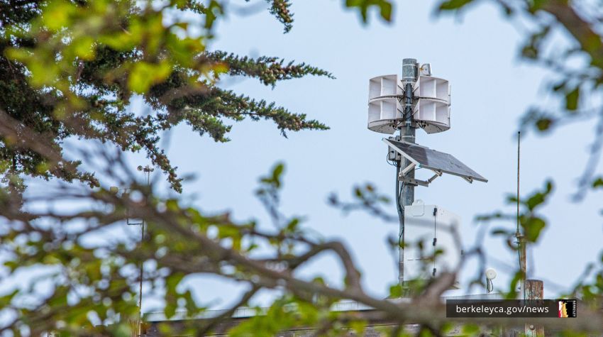
New warning system adds another layer to emergency notifications, signaling to those outdoors to seek more information from City’s emergency map, and AC Alert which requires sign-up.

A new outdoor warning system in Berkeley will use a wailing siren tone and voice message to prompt the public to seek emergency evacuation or shelter-in-place information, details of which will be on the City’s emergency map and alerting systems.
The siren and voice message would signal that people in some or all parts of Berkeley should take emergency protective action, which would differ depending on the emergency.
A wildfire might prompt a message to evacuate part or all of the hills. A tsunami message would direct people to get onto land, and out of Marina and the shoreline, away from the Bay. A different emergency might tell particular neighborhood to shelter-in-place.
People in unaffected areas should also stay up-to-date with real-time emergency notifications. An evacuation for one neighborhood might require others to stay off roads. All of us play a role in an emergency.
Start now:
- Subscribe yourself and others in your household to AC Alert, a text and email alert system that can be tailored notify you of emergencies in specific locations.
- Practice searching for your home on Berkeley’s Emergency Map, which first responders use to give neighborhood-specific protective actions in real-time.
When you hear Berkeley’s new outdoor warning system, use these tools to gather emergency information to help you take action.
Warning system flexible for a variety of disasters
Atop buildings across Berkeley – from the Marina to the hills, from south to north – the system is intended to be another layer of notification, reaching people outdoors.
The goal is to amplify – and guide people to – the principal emergency tools while being flexible enough to respond to a variety of different disasters, be it a tsunami or wildfire.
These sirens were made possible by Berkeley voters’ passage of Measure FF in December 2020. After a period of study and assessment, installation started earlier this year. The siren system is tied to the PG&E grid, and it also has a solar-powered battery backup that can be activated by landline, cell phone, computer, or satellite.
To date, ten sirens have been installed. The remaining five are projected to be installed by early 2024.
If you want to get familiar with the sirens’ sounds and voice messages, listen to example messages.
Know how to evacuate safely
Knowing information is only one step. Take the required action.
For those who live near wildfire zones or in the hills, use our step-by-step Fire Weather Planning Tool as a guide. You’ll document where you’ll stay, who in your house needs help, creating a go-bag, and how you’ll evacuate – including two routes by foot and two by car.
When the siren sounds, a plan will help you protect yourself and your household. Successful evacuation of entire neighborhoods depends on as many people as possible doing their part and following the guidance from AC Alert and Berkeley’s emergency map.
Being prepared for the signal will help you act fast. Subscribe to AC Alert and try using Berkeley’s emergency map.
Links
- AC Alert
- Berkeley Emergency Map
- Use Berkeley's Emergency Map to find critical, real-time information by location
- Fire weather planning tool
- Wildfire evacuation checklist
- Outdoor Siren Warning System
- Outdoor Warning System: example alerts
- Emergency notification tools
- Fire weather and evacuation
- Vegetation management
Media Contact
Strategic Plan Goal


