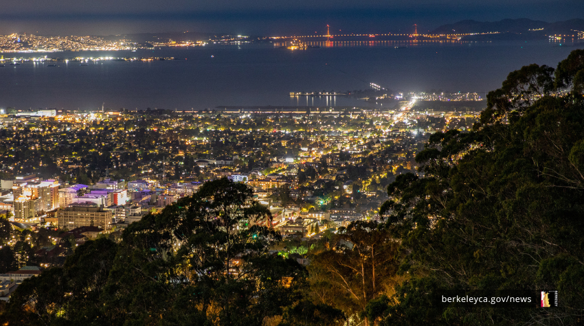
Understand Wildfire Risk in Berkeley Hills
Residents throughout the Berkeley hills highest risk areas must meet different wildfire safety requirements based on their property’s location.
Those in higher wildfire risk areas need to follow additional requirements and recommendations to help reduce their increased chance of wildfire loss.
All hill residents should create defensible space around their homes, including maintaining a buffer zone of at least five feet, trimming vegetation, and keeping roofs, gutters, and yards clear of debris to better protect their homes and neighborhoods from wildfire.
Many residents in these areas may qualify for City programs and services that support vegetation management, home hardening, and other wildfire risk reduction work. Residents anywhere in Berkeley can use the City’s Chipper Program to remove excess vegetation on residential properties.
Start by entering your address on Berkeley FireSafe to find out your wildfire risk area.
Residents in upper hills have highest wildfire risk and requirements
Wildfire risk is greatest for residents in both the Grizzly Peak and Panoramic Mitigation Areas – which extend from Piedmont east to the city boundary and from Grizzly Peak east to the City boundary.
Wildfire risk in this area poses the greatest risk to life, property, and natural resources. Cal Fire identified these neighborhoods as critical areas for slowing wildfire spread based on wildfire risk modeling and lessons learned from recent wildfires.
These residents must follow local wildfire laws, maintain defensible space, and should schedule and complete inspections.
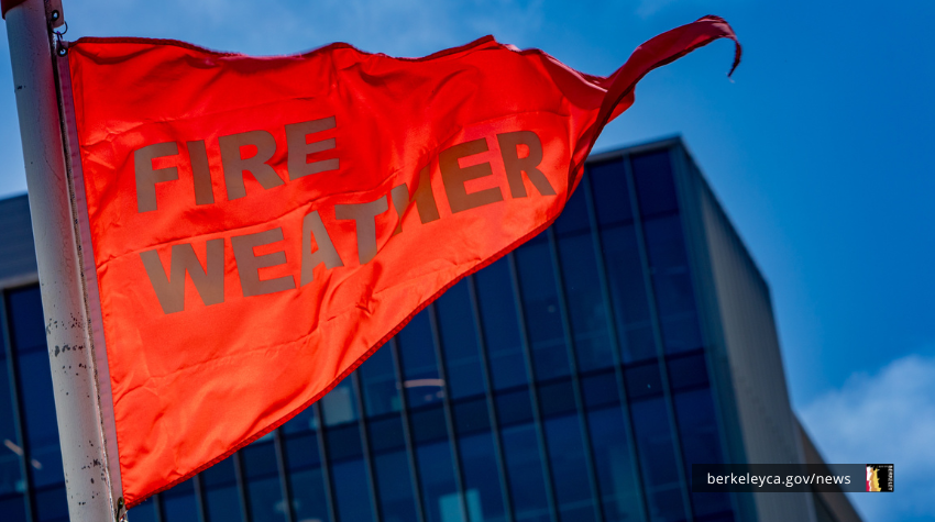
Maintaining buffer space doesn’t just protect your home. This work also helps reduce the potential for wildfire to rapidly spread through the hills during dangerous fire weather conditions.
Residents in these areas receive annual inspections to guide how to safeguard their property. These residents must:
- Remove all vegetation and other combustible materials within the first five feet of their homes and structures.
- Remove wooden gates and fences that are attached to and within 5 feet of the home or structure. You can also replace them with non-combustible alternatives, such as metal.
- Maintain trees that are taller than their roof line by keeping them pruned and removing any fallen debris on the ground, roof and in gutters
- Use fire-resistant building materials when building or completing major home improvement projects that require permits
Residents are only responsible for maintaining defensible space on their property.
Residents in this highest risk area may qualify for these City programs to help complete wildfire-risk reduction work, including:
- Resident Assistance Program
- Home Hardening Mesh Program
- Home Hardening Rebate
- Eucalyptus Understory Cleanup Program
- Firewise Support
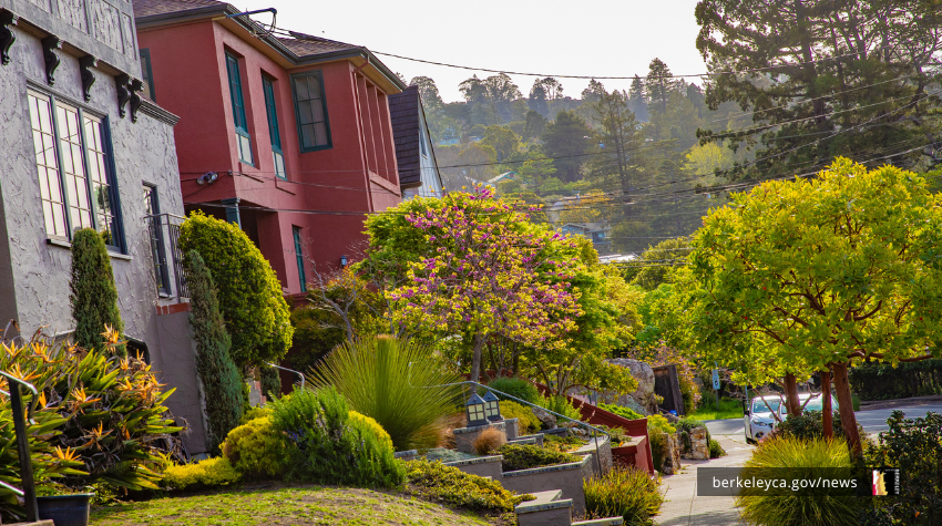
Residents next to the highest risk areas: create defensible space and follow required building guidelines
Wildfire risk remains very high for residents who live just west of Grizzly Peak Boulevard, an area referred to as a Very High Fire Hazard Severity Zone. To get information based on your property, you can schedule an inspection with a wildfire expert to help you identify potential wildfire hazards.
Residents in these areas are required to maintain defensible space within the first five feet of their home, similar to their Grizzly Peak and Panoramic neighbors. Within the first five feet around structures, these residents must:
- Maintain plants to limit their risk to the home by keeping them free of dead material, trimmed and inside pots or planters away from the ground where possible.
- Choose lower-growing succulents, vegetation, shrubs, and bushes
- Keep tree branches pruned so they do not overhang or touch roofs, walls, or other structures
Outside of these first five feet, residents in these areas must maintain the areas around their structures to prevent wildfire from spreading to their homes.
Residents in this area can reduce wildfire risk by using these City programs:
- Use the Chipper Program to remove excess vegetation on their property.
- Order a vegetation debris bin if you live in a higher-risk neighborhood that qualifies for this service funded by your property tax surcharge.
- Check if you qualify for the Home Hardening Rebate to receive money back for making permanent home improvements such as installing a Class A fire-rated roof or multi-paned windows.
Residents along lower areas of the Berkeley hills: Get help removing vegetation or making required building safety upgrades
High wildfire risk remains for residents in lower areas of the Berkeley hills, which are referred to as the High Hazard Severity Zones. Residents in these areas are strongly encouraged to take voluntary annual action to protect their homes.
The Chipper Program can help residents remove excess vegetation.
When building new structures or remodeling existing ones, residents should follow same rules as those in other areas of the hills.
Residents can create defensible space using three “ignition zones”
Hill residents are most likely be the first affected by wildfires that start in undeveloped areas. Residents can reduce wildfire risk by creating defensible space, trimming vegetation, and keeping roofs, gutters, and yards clear of debris.
Residents in the Grizzly Peak and Panoramic Mitigation Areas and the Very High Zone are required to maintain defensible space. They can view their property into three manageable “ignition zones” to understand what to do in different parts of their property to reduce wildfire risk.
Start with the most critical areas closest to the home then gradually extend your fuel reduction efforts outward. This kind of protective work slows the spread of fire and lessens chances that fires will reach structures.
0-5 feet around your home (Ignition Zone 0 or “Ember-resistant zone”)
The first 5 feet around your home is the most important area to clear of vegetation and combustible materials since it is closest to buildings, structures, and decks.
In this five-foot area, dead vegetation creates the highest risk for ignition. However, even living vegetation can pose a threat in Ignition Zone 0, especially for properties in the hills.
Create a non-combustible 5-foot border around your home by:
- Removing vines on buildings, fences, or vegetation within 5 feet of buildings
- Regularly trim, prune, and cut dead, dying, and overgrown vegetation
- Using gravel, pavers, or concrete instead of combustible bark or mulch
- Limiting flammable items (like outdoor furniture and planters) near structures and on top of decks
While these steps are recommended for all properties in the Very High Fire Hazard Severity Zone, they are required in the Grizzly Peak and Panoramic Mitigation Areas.
5 to 30 feet from your home (Ignition Zone 1 or “Lean, Clean, and Green Zone")
This area should be kept healthy and maintained. You should regularly clear dead or dry vegetation and create space between trees and individual plants, adding to the buffer between structures. Keep large hedges or bushes to less than 10 feet in diameter where possible.
Keep your home lean, clean, and green by:
- Removing all dead plants, grass, weeds, dry leaves, pine needles, and eucalyptus trees' underlying layer of vegetation (or understory)
- trimming trees regularly to keep branches a minimum of 10 feet from other trees
- creating a separation between trees, shrubs, and items that could catch fire, such as patio furniture, wood piles, swing sets, etc.
30 to 100 feet from your home (Ignition Zone 2 or "Fuel Reduction Zone")
This zone the last buffer in defensible space. Manage vegetation in this zone to reduce the risk of fire spreading to your home.
Slow wildfires from spreading by:
- choosing low-growing native vegetation with leaves that are drought-resistant and water-efficient, like those on our recommended plant list
- cutting or mowing grass down to a maximum height of four inches
- creating proper spacing between grass, shrubs, and trees
Following specific guidelines for each buffer zone and using City resources will help you create and maintain defensible space, which is essential for reducing loss from wildfire and protecting lives and property.
For residents with special circumstances or requests to reach wildfire resilience in other ways, contact us:
Wildland Urban Interface (WUI) Division
(510) 981-5620
wildfire@berkeleyca.gov
Use Berkeley's wildfire risk StoryMap to learn how wildfire risk varies across the hills and understand the factors that influence risk in different neighborhoods